Site Recorder 4 Tour: Drawing Site Plans and Regional Maps

Back | Tour Start | Next
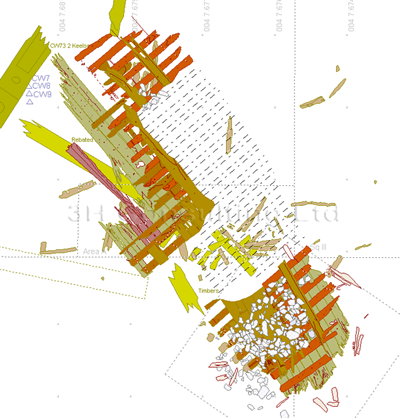
Site Recorder 4 includes tools to allow you to draw detailed site plans then print them at any scale. As well as printing, plans can be shared with other GIS and CAD programs or can be pasted directly into documents and presentations.
Plans can be drawn by hand by adding points, lines, circles and text or they can be imported from existing drawing files. Tools are included for setting line and fill colour, line and fill style, font and orientation. Charts and maps can be drawn using metres, feet or other distance units and using grid or geographical (Lat/Long) co-ordinates.
Site Recorder can display raster pictures on the chart as well as simple vector drawing objects. Images from sidescan sonar or multibeam sonar can be added to the site plan, overlaid with the drawings of finds, features, trenches and other drawing objects.
Site Recorder supports an unlimited number of drawing layers so related parts of a drawing can be grouped together. Layers can be shown or hidden allowing only parts of a plan to be displayed and they can also be locked against accidental modification. The layers themselves can be grouped into projects so layers containing data from, say, one seasons fieldwork can be grouped together.
Site plans drawn in Site Recorder can contain information from many season's work on separate layers so it is possible to view the site as it was at any point. This makes it possible to see how the work has progressed and how the site has evolved between each phase of recording.
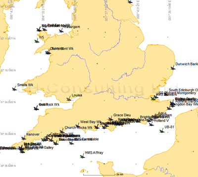
Site Recorder is also used for mapping large areas or for creating regional shipwreck databases. Coastline and map data can be imported from vector format GIS files and shipwreck information imported from existing lists.
This information can be coupled with geophysical survey data or reports from divers to form an integrated digital map.

The Cattewater Wreck drawn in Site Recorder
Individual wrecks within the Site Recorder regional file can be linked directly to other local files that cover just that specific wreck forming a powerful tool to help with the management of cultural heritage.
Part of a shipwreck database for the United Kingdom
Back | Tour Start | Next
