
Techniques > Sites > Tresco Channel
Site: Searching Tresco Channel
Techniques: Circular Search


|
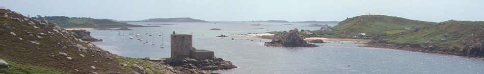
Tresco Channel is a narrow stretch of water between the islands of Tresco and Bryher in the Isles of Scilly which lie off the western tip of Cornwall, UK (Fig. 1).
Medieval pottery had been found some time ago by divers investigating the seabed in Tresco Channel and in 2001 a local diver reported that green glazed pottery was often found there and was mostly French in origin. A dive at the time only revealed small, isolated fragments of green glazed pottery. The Archaeological Diving Unit (ADU), the UK Government diving contractor at that time, investigated the site in 2001/2 but they did not take the matter any further.
Then in 2010 more pottery was recovered by a local diver from an area of yacht moorings in the Channel. Tides in the area reach 5m (16ft) in height and slack mooring chains at low water drag across the seabed so the movement of the chains appeared to be uncovering the pottery. In 2011 a project was put together by CISMAS to investigate the site (Fig. 2).
The primary objective of the project was to search the seabed in the area where the recently recovered pottery was found to determine its extent and distribution. By mapping the location of each piece of pottery it should be possible to determine if the pottery scatter has a focus or is randomly distributed. The pottery was to be recovered so that the date range and origin could be determined.
This project was undertaken jointly by the Cornwall and Isles of Scilly Maritime Archaeology Society (CISMAS) and the US research foundation ProMare.
Click on any image below to show a larger version.
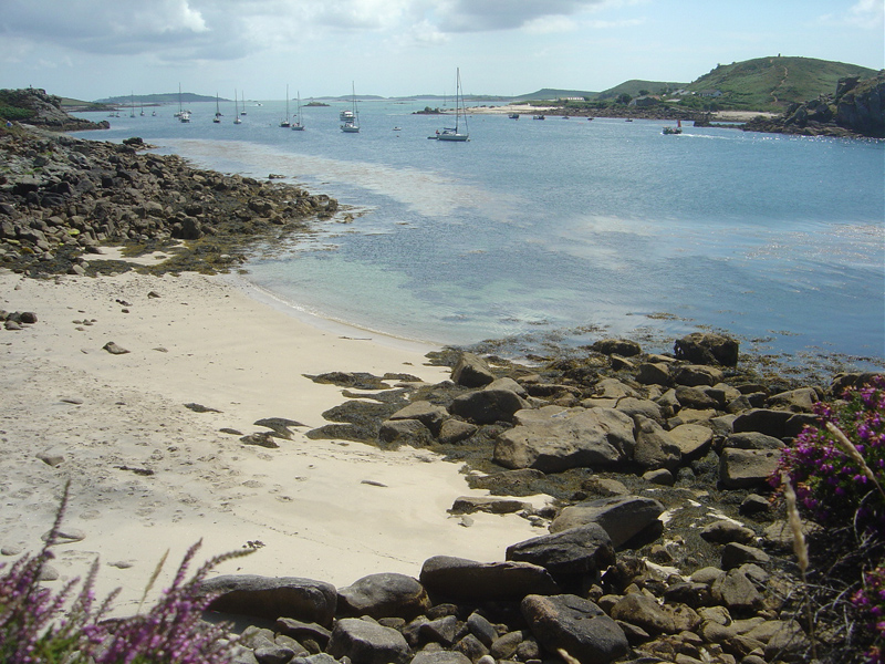
Fig 1: Tresco Channel, Isles of Scilly
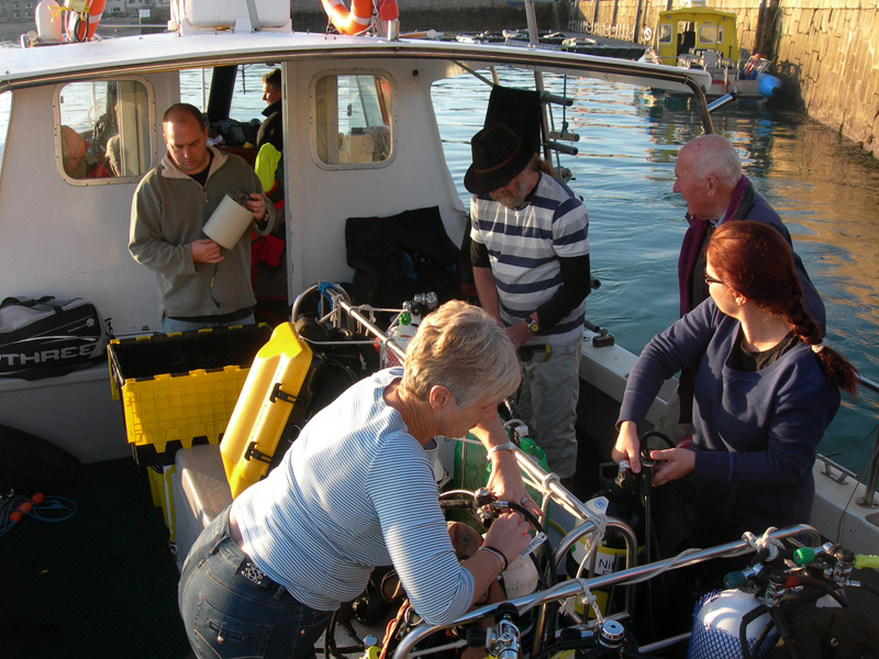
Fig 2: The CISMAS/ProMare team preparing to go diving
Search Method
The area where the pottery had been found was in amongst a line of shallow water yacht moorings that run the length of Tresco Channel so these became the focus of the search. The circular search method was used to locate any pottery visible on the surface. To do this, each dive team first clipped a distance line on a reel to a shot weight on the seabed at the centre of the search area (Fig. 4). The distance line was run out until the shot weight could just be seen, a distance that depended on the visibility underwater, and the second diver took up position between the weight and the diver carrying the line reel. The divers then swam around the weight searching the seabed while keeping the distance line tight so they swam in a circle. When the circle was completed the distance line was let out the same distance as before, usually a few metres, and the search continued in a slightly larger circle. The area was searched in a series of concentric rings out to a distance of 25m (82ft) from the centre.
The position of each shot weight was known as it had been carefully positioned using a hand-held GPS from a boat on the surface. When an artefact was located during the search, the position was recorded by noting the distance to the shot weight using the marked distance line along with the back bearing to the shot using a diver’s magnetic compass. Knowing the position of the shot at the centre of the search, the distance from the shot and the back bearing the position of each artefact could be calculated.
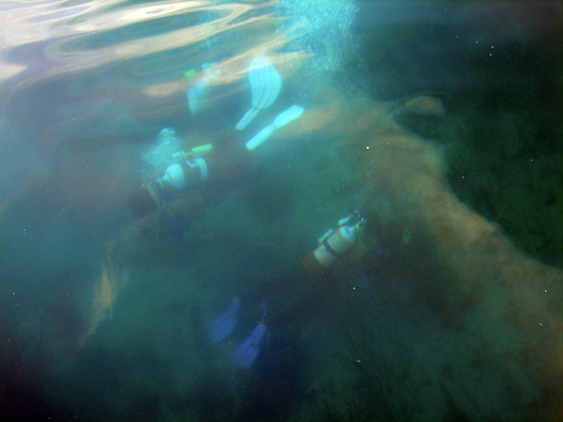
Fig 3: At low tide on a day with good visibility the searching divers could be followed from the surface
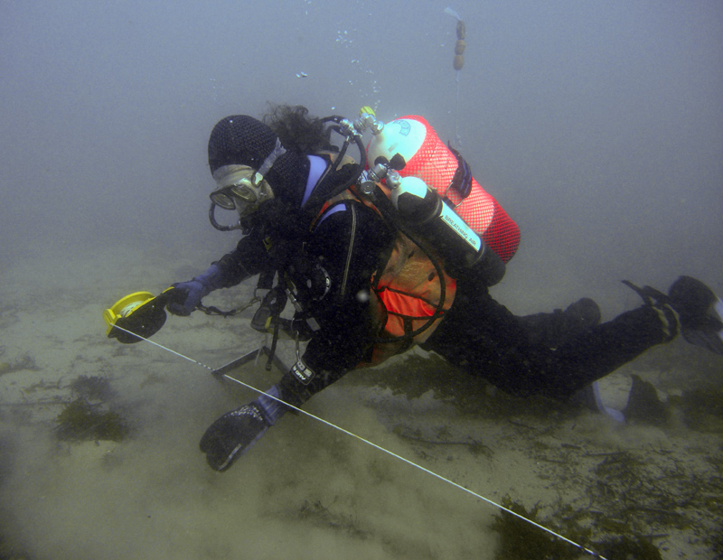
Fig 4: Diver with a distance line and reel
Subsequent circular searches were carefully positioned to slightly overlap adjacent circles so that a complete coverage of the search area was obtained (Fig. 5). A total of eleven circular and three jackstay searches were made, each search being given a unique number and plotted in Site Recorder as radial measurements (Fig. 6). The total area searched was approximately 6000 square metres.
Positioning of the circular searches was planned around the estimated positions for the mooring buoys and the area of seabed scoured by the mooring chains. The initial searches were done using the mooring blocks as the centre point while later searches were done using a shot line deployed from the surface at a pre-defined location.

Fig 5: The planned search areas (green circles) around two of the moorings (blue dots)
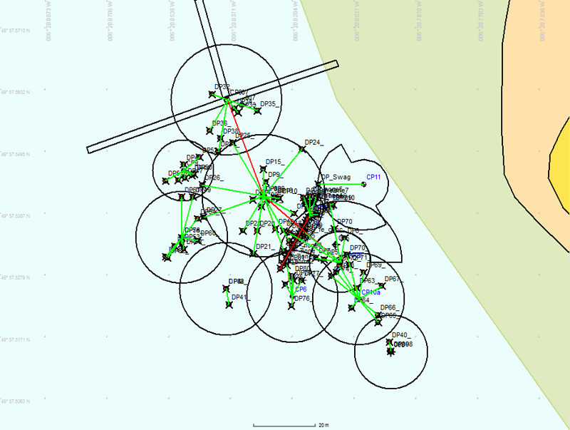
Fig 6: Search areas and located objects positioned using radial measurements (green lines)
Position Accuracy
Primary positioning on the surface was done using a Garmin 76C WAAS enabled hand held GPS receiver with an estimated precision of 4m (13ft) (95%). The artefacts were positioned using radial measurements back to a central shot line which required distance and bearing measurements. The precision of a hand held magnetic compass is in the order of 5° which equates to a position uncertainty of 1.8m (6ft) at 20m (66ft) distance from the centre of the search area. Including the GPS error the estimated precision of absolute position for any artefact is better than 6m (20ft). However, in practice the repeatability was much better than 6m, the calculated positions for objects that had been identified on two separate searches agreed to better than 2m (7ft).

Fig 7: The resulting scatter of pottery, bone and other objects located during the search
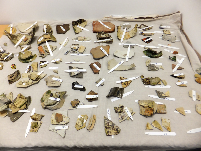
Fig 8: Some of the pottery recovered from the site
The 2011 survey recovered 269 fragments of medieval pottery from the seabed (Fig. 8). This pottery was analysed and found to be predominantly from the Saintonge region of France almost entirely of late 13th – early 14th century date.
An excavation of the site was undertaken by CISMAS in 2013, see Tresco Channel.